Friday 18 November 2022

Gilberts Quasi Post Apocalyptic Picnic.

 So: a Cornish greenstone comes to Norfolk, perhaps not to rest but at least to reside for a while.

Although arriving this time by post, let's entertain an alternative travelog. Eroded out of the high mountains of the Variscan Orogeny - thrown up 350 million years ago give or take, when continents collided and the Cornubian batholith grumbled and cooked its metamorphic onion layers; then carried by flash torrents north-east into the Triassic desert sandstone beds now of the English Midlands. After a lengthy rest, remobilised, carried east by a wide river rolling and tumbling from the Cambrian mountains to the area that would become the North Sea basin. Maybe it halted who knows where on the way, but then in latter times was caught up in the cut and thrust and gush resulting from one of the several ice tides that crawled south and east until surfacing for the time being in Norfolk.

Now on display in a small woodland, resting on this neglected picnic bench, it seems somewhat out of time in this quasi-post-apocalyptic evocation - but then, after a journey like that you would wouldn't you? However, change being the only constant, a more extended perspective would suggest this rest is only temporary.


The picnic table will soon return to the earth but I like to think that descendents of the inquisitive roe deer who have lately nudged the Gothvos stone off the table's lichen encrusted edge might still find harbour in this woodland yet a while - 

wherever and on whatever continent it may be.

https://1drv.ms/b/s!AhgwsrshU6vek2xOpiJUBZGsxNAB?e=WC5BCb


Gilbert Addison 08.10.22 Anthropocene/Holocene/Quaternary/Cenozoic

Tuesday 10 May 2022

Calm in Karstlands with Nadneen Samudri.

  West Jamaica

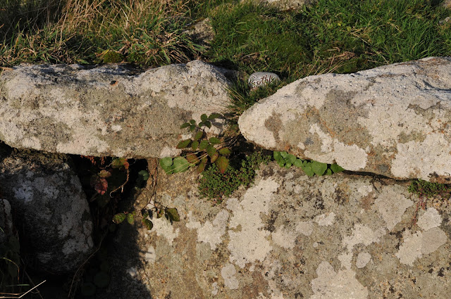
Gothvos Stone deposited and photographed by Nadneen Samudri in Cockpit Country Jamaica,  Jamaica and the other islands of the Antilles evolved from an arc of ancient volcanoes that rose from the sea millions of years ago.  

During periods of submersion, thick layers of limestone were laid down over the old igneous and metamorphic rock.  In many places, the limestone is thousands of feet thick.  

The country can be divided into three landform regions: the eastern mountains, the central valleys and plateaus, and the coastal plains.

The highest area is the Blue Mountains range.  These eastern mountains are formed by a central ridge of metamorphic rock running northwest to southeast from which many long spurs jut to the north and south.

 For a distance of over 3 kilometres (1.9 mi), the crest of the ridge exceeds 1,800 metres (5,900 ft).  The highest point is Blue Mountain Peak at 2,256 metres (7,402 ft).  The Blue Mountains rise to these elevations from the coastal plain in the space of about 16 kilometres (9.9 mi), thus producing one of the steepest general gradients in the world.   In this part of the country, the old metamorphic rock reveals itself through the surrounding limestone. To the north of the Blue Mountains lies the strongly tilted limestone plateau forming the John Crow Mountains.  This range rises to elevations of over 1,000 metres (3,300 ft).  To the west, in the central part of the country, are two high rolling plateaus: the Dry Harbour Mountains to the north and the Manchester Plateau to the south.  Between the two, the land is rugged and here, also, the limestone layers are broken by the older rocks.  Streams that rise in the region flow outward and sink soon after reaching the limestone layers.

The limestone plateau covers two-thirds of the country, so that karst formations dominate the island.  Karst is formed by the erosion of the limestone in solution.  Sinkholes, caves and caverns, disappearing streams, hummocky hills, and terra rosa (residual red) soils in the valleys are distinguishing features of a karst landscape; all these are present in Jamaica. To the west of the mountains is the rugged terrain of the Cockpit Country, one of the world's most dramatic examples of karst topography.


SEA GRAPES

BY DEREK WALCOTTThat sail which leans on light,tired of islands,a schooner beating up the Caribbeanfor home, could be Odysseus,home-bound on the Aegean;that father and husband'slonging, under gnarled sour grapes, islike the adulterer hearing Nausicaa's namein every gull's outcry.This brings nobody peace. The ancient warbetween obsession and responsibilitywill never finish and has been the samefor the sea-wanderer or the one on shorenow wriggling on his sandals to walk home,since Troy sighed its last flame, and the blind giant's boulder heaved the trough from whose groundswell the great hexameters come to the conclusions of exhausted surf.
The classics can console. But not enough.


The coastline of Jamaica;  The northeast shore is severely eroded by the ocean. There are many small inlets in the rugged coastline, but no coastal plain of any extent.  A narrow strip of plains along the northern coast offers calm seas and white sand beaches. Behind the beaches is a flat raised plain of uplifted coral reef.

The southern coast has small stretches of plains lined by black sand beaches. These are backed by cliffs of limestone where the plateaus end.  In many stretches with no coastal plain, the cliffs drop 300 metres (980 ft) straight to the sea.[1] In the southwest, broad plains stretch inland for a number of kilometres. The Black River courses 70 kilometres (43 mi) through the largest of these plains.  The swamplands of the Great Morass and the Upper Morass fill much of the plains. The western coastline contains the island's finest beaches and at least one perfect Greenstone Pebble brought there from Kernow by Nadneen Samudri.


Thursday 14 April 2022

Momentous Intent with Johnny McGovern δράω

Perhaps after I have posted Johnny McGoverns elusive and at the same time, fine photographic study of a mysterious West Penwith Well, perhaps when Johnny sees his image of the well, no longer trapped inside his camera, nor floating in the digital ether of his computer, perhaps then he will know if there is actually anything further to say besides, "In this Well did he place a Gothvos stone".


He may recall sensing a spark or smooth coolness in his palm emanating from the stone as he positioned that pebble, although I conclude these scenarios from my own experiences, placing Greenstone for the moment as I have done before but this placing is Johnny's placing, not mine.


A Stones Throw.
The clear photography yields detail but less reliance on spirits and shadows than the blurred Gothvos images taken previously with a plastic camera in Turkey, motivating stories on a cultural, geographic threshold obscured by distorted shadows, bleaching light, desert cedars and resins stimulated by the Sun and the Cicada. In Johnnys photographs the inscription is clear, fine granules of Mylor Slate re-heated by volcanic activity can be discerned, micro fossils and quartz intrusions, A stone material favoured by Cornish Greenstone Axe-Head polishers who gleaned this rock from the now submerged forest quarries of Mounts Bay and Gwavas Lake that have all but sunk and continue sinking.


The well is a water course and the Gothvos Stone represents, (among other things) the votive Greenstone Axe Heads that were evidently positioned in rivers and lakes by people alive in the Bronze Age, to whom we people connect, far greater a connection than through affectations such as wealth or status. I am bending the arc of Johnny's narrative-free activity in order to divine an outer pragmatism, a ritual, a detail of conjuring that I can use as a metaphorical bridge across the marsh of the mythos, where things beyond reasonable doubt risk being taken down "a peg or two" gradually the products and undertakings of these "marshy areas" are treated with  more Human-Scale definitions, the few Special things were sacred because they stood out exclusively to those who were seeking them. Those things were blessed although, not by the church. They walked under clearer skies and brighter stars, they drank clear water and breathed fresh air, they organised existence and mythos as the same.


Walking doesn't require navigation, in West Penwith there are many notable carns, cairns and stones with a few church towers, aerials and aircraft tracking devices that are permanent enough to use as simple wayside markers or as alignments between features, Given time and familiarity there are great miracles to uncover from the seasons growth, subterranean water courses, sunken mines and tidal phenomena, there is no reason to rehearse unless the formality of rehearsal uncovers the hitherto unknown, each rehearsal is distinguished by its difference.
 The core modus operandi of old ways can never really be known either, each attempt distances the enquirer further and further into amalgamous terra nova as befits the insulations of urbanity and reliance upon some form of capital, this idea seems to thrive once it has exhausted the realms of reason. 
How elemental are the constituent factors of this moment drawn of five photographs recording a moment in the event, an assemblage of hewn granite itself an armature for lichen, tendrils and moss, the sod has become mortar for a living organism and yet at its inception it was hostile, radio active and molten. Could the action of an intervention here in this old pasture invite the notion of something other, not just a landscape feature indicating available, potable water, but something more like a portal dispensing or exchanging other than water, is this Dromenon


Johnny the solitary wanderer Mág Samhradháin on his summery excursions throughout  East Breffny (Bréifne), Dumnonia and Kernow, did he navigate, with what did he know his own whereabouts?, his imagination? Did he lay markers or carry devices, yes a box full of air and a smile.